Updated Hazard Maps for Selected Metro Manila Communities
Hazard and impact maps were developed for four barangays on selected earthquake and flood scenarios, applying the Child-Centered Urban Resilience Framework that aims to strengthen the adaptive capacity and resilience of the local authorities and children of these communities against disasters.
Description
The mission of Earthquakes and Megacities Initiative is to advance knowledge, policy, and practice of urban disaster risk reduction, particularly focusing on megacities and fast-growing metropolises. Its dedication to shaping the global agenda and practice of urban resilience in some of the most complex cities in the world are aligned with the goals of the SFDRR to build resilience, and reduce disaster risk and losses globally. Fulfilling EMI’s mission necessitates the involvement of governments and local communities towards making concrete actions to achieve the same goal which is embodied in the concept of mainstreaming where the methodologies of EMI are anchored in by engaging the stakeholders in a participatory process that allows collaboration, ownership, and development of their capacities.
This approach of mainstreaming, together with the competencies of experts and staff in disaster risk management, GIS and Remote Sensing, urban resilience policy, and knowledge development and dissemination has allowed the successful implementation of the project to enhance the hazard maps in the four barangays in Quezon City and Valenzuela, Philippines. The project entailed the development of maps for flood and earthquake scenarios, and the identification of critical public facilities in the barangays.
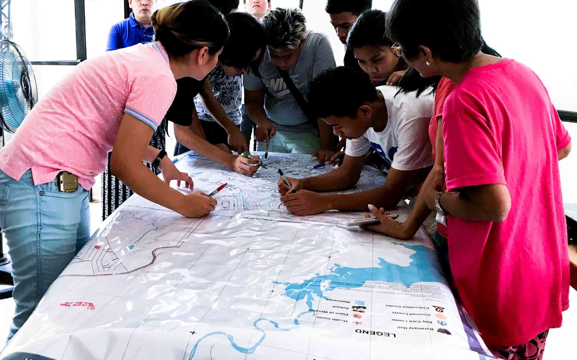
In the development of these maps, focus group discussions and participatory mapping exercises were conducted with key barangay officials, and women and children representatives from the communities to capture the local perspectives on disaster risk, hazards and protocols. These strategies also facilitated the validation of the locations of critical facilities and safe spaces for the community. This inclusion of the stakeholders in the mapping process promotes the strengthening of the adaptive capacities of the barangay and the community in disaster mitigation and preparedness. At the same time, the representation of women and children in the consultative and validation process build their awareness and knowledge of the disaster risks that they are exposed to.
Did the Sendai Framework change or contribute to changes in your activities/organization? If so, how?
The transition from Hyogo Framework for Action to the Sendai Framework for Disaster Risk Reduction in 2015 has made a formidable emphasis on prioritizing of resilience, and capacity-building of governments, which is where the mission of EMI is grounded in.
These changes facilitated the alignment of the outcomes of the succeeding projects of EMI under the Priorities for Action and Targets established by the SFDRR, allowing for more tangible, measurable, and results-oriented objectives and activities.
In supporting local governments, EMI has promoted the mainstreaming of science-based disaster risk reduction within the functions of its partner cities through the use of participatory approaches and knowledge sharing activities.
What led you to make this commitment/initiative?
What was your position before making this Voluntary Commitment / prior to the Sendai Framework?
The mission of EMI has always been aligned to address the need of urban populations to reduce their exposure and vulnerabilities to disasters, that inflict large damages and claim numerous lives. The advent of the Hyogo Framework in 2005 spurred EMI’s relevance as it aligned its objectives with the framework’s goals to reduce disaster risk from natural hazards.
At present, with the transition to the Sendai Framework in 2015, EMI has wholly committed its role to champion and advocate for building capacities of local governments to safeguard its citizens against disasters.
To further the cause of disaster risk reduction and resilience among urban communities, EMI implemented a participatory process engaging all stakeholders in the development of the hazard and impact maps, including decision-makers, community members, and representatives from vulnerable groups. This collaborative process ensures that the maps generated reflect accurate situation on the ground, validates data utilized, and facilitates knowledge transfer and capacity-building of the engaged stakeholders.
Deliverables and Progress report
Deliverables
Deliverables are the end-products of the initiative/commitment, which can include issuance of publications or knowledge products, outcomes of workshops, training programs, videos, links, photographs, etc.
The project developed hazard and impact maps for Barangay Bagong Silangan and Tatalon in Quezon City, which indicates the following disaster information: flood impact, flood susceptibility (including affected buildings, displaced populations, health impact), and 7.2-magnitude earthquake impact, along with documentation reports.
The maps were used as geospatial reference data, hazard data for earthquake and flood, and exposure data from official government data, existing hazard studies, and open-source data.
The project developed hazard and impact maps for Barangay Ugong, and Gen. T. De Leon in Valenzuela, which indicate the following disaster information: flood impact, flood susceptibility (including affected buildings, displaced populations, health impact), and 7.2-magnitude earthquake impact, along with documentation reports.
The maps were used geospatial reference data, hazard data for earthquake and flood, and exposure data from official government data, existing hazard studies, and open-source data.
Organizations and focal points
Implementing Organization(s)
Focal points
If a VC's contact information has been hidden, the SFVC team can forward a message.